- Home Page /
- Books /
- Travel /
- United States /
- West /
- Pacific /
- Desolation and Granite Chief Wilderness Areas...

Item #:
143307298
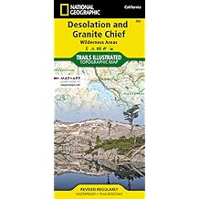
Desolation and Granite Chief Wilderness Areas Map (National Geographic Trails Illustrated Map, 802) Map Folded Map, January 1, 2023
Item #:
143307298
€ 21
Price Details
Excluding Shipping & Custom charges ( Shipping and custom charges will be calculated on checkout )
*All items will import from US
0 ratings
Write a review
In stock
QTY:
Order now and get it around Wednesday, June 24
Secured transaction
Ubuy works hard to protect your security and privacy. Our advanced payment security system ensures confidentiality by encrypting your information during transmission using AES (Advanced Encryption Standards) and SSL (Secure Socket Layer) protocols. Your payment details are 100% secure as we do not share your payment details with third party sellers.
Our Top Logistics Partners
The Desolation and Granite Chief Wilderness Areas offer remote trails that make their way deep into the backcountry.
Buy Now Pay Later
Fast
Shipping
Free
Return*
Secure Packaging
100% Original Products
PCI DSS Compliance

ISO 27001 Certified
Note: Step Down Voltage Transformer required for using electronics products of US store (110-120). Recommended power converters Buy Now.


What Stands Out
Detailed Coverage
This map offers comprehensive coverage of the Desolation and Granite Chief Wilderness Areas, ensuring that outdoor enthusiasts can navigate trails and features with confidence.
Durable Format
Designed as a folded map, it is lightweight and easy to carry, making it ideal for hiking and backpacking without the hassle of digital devices.
Trusted Brand
Produced by National Geographic, this map combines expertise and reliability, providing users with accurate information and trusted adventure guidance for their wilderness exploration.
Product Details
| Item Weight | 0.2 lbs (90 grams) |
Who Should Buy?

-
Hikers
Ideal for hikers seeking detailed trails, terrain features, and navigation assistance in the Desolation and Granite Chief Wilderness areas.
-
Campers
Perfect for campers wanting to explore camping spots and backcountry areas with reliable topographic information in wilderness regions.
-
Outdoor Enthusiasts
Great for outdoor enthusiasts planning multi-day trips, providing comprehensive routes and landmarks for navigation in rugged terrain.

-
Casual Users
Not suitable for casual users who need simple maps or minimal details for leisurely strolls or urban navigation.
-
Non-Outdoor Types
Not recommended for individuals uninterested in outdoor activities, as the map caters specifically to wilderness adventures.
-
Digital-Only Users
Unsuitable for users who prefer digital navigation tools and apps instead of traditional folded paper maps.
Product Description
Desolation and Granite Chief Wilderness Areas Map (National Geographic Trails Illustrated Map, 802) Map Folded Map, January 1, 2023
Have any Query? Chat with us
Customer Questions & Answers
-
Question:
What is included in the Desolation and Granite Chief Wilderness Areas Map?
Answer: The Desolation and Granite Chief Wilderness Areas Map includes detailed topographical information, hiking trails, campsites, water sources, and recreation areas. It is designed by National Geographic’s Trails Illustrated, which ensures high-quality cartography and up-to-date trail information. This map is particularly useful for outdoor enthusiasts looking to explore the picturesque landscapes, lakes, and mountainous terrains in these wilderness areas. Whether you are a seasoned hiker or a novice adventurer, this map serves as an essential guide to navigating these expansive areas. -
Question:
Is the Desolation and Granite Chief Wilderness Areas Map waterproof?
Answer: Yes, the map is printed on durable, tear-resistant paper that is also waterproof. This feature is crucial for outdoor activities where weather conditions can change unexpectedly. The waterproof material allows you to consult the map in rain or snow without risking damage. This durability makes it an ideal choice for hiking, camping, and other wilderness excursions, ensuring that it remains intact during your adventures. -
Question:
How detailed is the topographic information on the map?
Answer: The topographic information on the Desolation and Granite Chief Wilderness Areas Map is highly detailed, featuring contour lines, elevation markers, and various natural landmarks. This level of detail allows users to understand the terrain better, helping them plan their routes accordingly. Hikers can track elevation changes, which is particularly beneficial for challenging trails. The quality of this topographic information enhances navigation for both hiking and backpacking excursions, giving you a clear visual of the area. -
Question:
Can I use this map for mountain biking in the wilderness areas?
Answer: While the primary focus of the Desolation and Granite Chief Wilderness Areas Map is on hiking trails, many paths are also suitable for mountain biking. The map indicates multi-use trails, helping cyclists find routes that accommodate biking. Additionally, it provides information on the terrain, allowing bikers to prepare for challenging sections. Always check local regulations regarding trail use to ensure a safe and enjoyable biking experience. -
Question:
Is this map updated regularly to reflect trail changes?
Answer: The Desolation and Granite Chief Wilderness Areas Map is regularly updated by National Geographic to capture any important changes in trail conditions, paths, and area features. Such updates are essential as trails can undergo modifications due to weather, maintenance, or other factors. Keeping an up-to-date map with you ensures that you have the most accurate information for your wilderness exploration, which enhances both safety and enjoyment. -
Question:
What type of activities can I do using this map?
Answer: You can use the Desolation and Granite Chief Wilderness Areas Map for a variety of outdoor activities, including hiking, camping, fishing, and picnic areas. The map outlines trails and campsites, making it a versatile companion for a day trip or extended outdoor excursion. Whether you seek a serene lake for fishing or scenic trails for hiking, this map helps you locate points of interest and plan your activities effectively. -
Question:
Is the map foldable, and how should I store it when not in use?
Answer: Yes, the Desolation and Granite Chief Wilderness Areas Map is designed as a foldable map, making it easy to carry and store. When not in use, it should be kept flat or folded carefully to avoid creases that can make it difficult to read. Consider placing it in a protective sleeve or a map case to ensure its longevity during your outdoor adventures. -
Question:
What scale is the map printed on, and why is it important?
Answer: The Desolation and Granite Chief Wilderness Areas Map is typically printed at a scale of 1:40,000, allowing for detailed representation of the terrain and features. This scale is crucial for hikers and outdoor adventurers, as it balances detail with adequate coverage, making it easier to navigate various trails and wilderness features. A suitable scale helps users make informed decisions about their routes and safety. -
Question:
How can I ensure I'm using the map correctly?
Answer: To use the Desolation and Granite Chief Wilderness Areas Map correctly, familiarize yourself with map symbols and legends provided. Practice laying the map out in conjunction with a compass to understand direction and orientation. Engaging in a brief dry run at home can boost your confidence. Whether you're navigating a new trail, planning a multi-day backpacking trip, or exploring backcountry areas, proper map usage enhances your overall experience. -
Question:
Where can I buy Desolation and Granite Chief Wilderness Areas Map National Geographic Trails Illustrated Map, 802 Map?
Answer: You can purchase the Desolation and Granite Chief Wilderness Areas Map at Ubuy in Finland. Ubuy offers a reliable option for acquiring this high-quality map, ensuring you are well-equipped for your outdoor adventures. Explore the available purchasing options to find the version that best meets your needs.
Pacific Editorial Review
### Editorial Review The National Geographic Trails Illustrated Map of the Desolation and Granite Chief Wilderness Areas has received overwhelmingly positive feedback from users, particularly those who appreciate high-quality outdoor navigational tools. With a clear emphasis on detail and usability, this map stands out for its excellent readability thanks to its light background color, which enhances contrast compared to other topographic maps. While it may lack the intricate details seen in US Geological Survey maps, customers value its balance of readability and rugged design, making it a popular choice among hikers and backpackers. Users have noted the protective features of the map, which is crafted from tough, waterproof material that resists wear and tear even in harsh outdoor conditions. This factor is crucial for adventurers requiring durable gear to withstand the elements. The map also provides critical information for backpackers, including the outlines of numbered camp zones for backcountry permits, further solidifying its status as an essential tool for navigating the Desolation Wilderness area. Overall, the National Geographic Trails Illustrated Map is regarded as one of the top choices for national park enthusiasts, offering a reliable and user-friendly resource for adventure seekers. ### Pros and Cons **
Customer Reviews & Ratings
1 customers ratings
-
5 Star
100%
-
4 Star
0%
-
3 Star
0%
-
2 Star
0%
-
1 Star
0%
Review this product
Share your thoughts with other customers
Pros
- Excellent readability with a light background color
- High-quality, tough, waterproof material
- Good level of detail with accurate trail depiction
- Useful for backpackers with permitting information
- Highly recommended by users familiar with various map brands
Cons
- Less detailed than USGS topo maps
Product Price History
Important information
- Limitations : For products shipped internationally, please note that any manufacturer warranty may not be valid; manufacturer service options may not be available; product manuals, instructions, and safety warnings may not be in destination country languages; the products (and accompanying materials) may not be designed in accordance with destination country standards, specifications, and labeling requirements; and the products may not conform to destination country voltage and other electrical standards (requiring use of an adapter or converter if appropriate). The recipient is responsible for assuring that the product can be lawfully imported to the destination country. When ordering from Ubuy or its affiliates, the recipient is the importer of record and must comply with all laws and regulations of the destination country.
- Not all the products listed on Ubuy are for sale, as Ubuy is a global search engine. Products are subject to export/trade regulations.
€ 21
Order now and get it around Wednesday, June 24
This item is not restrict in my country.(Please click on above link if this item is not restrict in your country, So our team will review and allow.)
QTY:
Secured transaction
Ubuy works hard to protect your security and privacy. Our advanced payment security system ensures confidentiality by encrypting your information during transmission using AES (Advanced Encryption Standards) and SSL (Secure Socket Layer) protocols. Your payment details are 100% secure as we do not share your payment details with third party sellers.
Our Top Logistics Partners
Fastest cross-border delivery
Features & Benefits
- Two wilderness areas tucked against west shore of Lake Tahoe
- Desolation Wilderness: 63,960 acres of subalpine forests, glacial lakes, and granite peaks
- Granite Chief Wilderness: 25,680 acres, beautiful valley meadows, and spectacular granite peaks
- Trail map for each wilderness area
- Waterproof and tear-resistant paper
- Supports exploration, conservation, research, and education programs